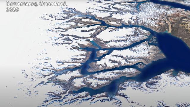
Google Earth has upgraded its Timelapse service to better perceive the evolution of the world, especially in 3D.
See the world evolve in fast motion, thanks to the images taken over the past 40 years by satellites. This is Google's promise with the announcement, this Thursday, April 15, a week before Earth Day, of an important evolution of Earth, its service for visualizing the surface of the globe. It is even "the most important update of Google Earth since 2017", according to the American company.
It must be said that the work to be done was titanic: the Mountain View firm had to digest nearly 24 million satellite images taken between 1984 and 2020, but also proceed to their animation, by superimposing photos of each region which were taken over the years. But thanks to the computing power of the American giant, what would have been impossible with an isolated PC has become possible via the cloud.
“In total, it took more than 2 million hours of processing on thousands of machines in Google Cloud to turn 20 petabytes of satellite imagery into a single 4.4 terapixel video mosaic,” according to Google. It's hard to figure out what 4.4 terapixels is, because it's a 4 followed by twelve zeros. To better understand this number, Google indicates that it is equivalent to 530,000 videos in 4K.
A view of Al Khiran, Kuwait:

Timelapse, a tool that also evolves over time
This feature, called Timelapse, is not new. It has existed since 2013, with improvements over time. What changes, according to Google, is a 3D view "to offer a whole new perspective on the changes affecting our planet". The use of Timelapse to observe climate change had already been well understood at the time, but not in such a form.
The tool, fascinating, is however not yet able to treat the whole world. The tool focuses on a few dozen places, grouped by theme (agriculture, deforestation, glaciers, infrastructure, megalopolises, mines, waterways, urban growth, natural disasters, terrestrial metamorphoses). Some of these places are accompanied by a story, to illustrate a particular problem.
Earth View
Source: Credit Pixabay PIRO4DHowever, even if the entire surface of the globe does not yet benefit from such 3D computer processing, it is quite possible to zoom in to observe with more or less detail the changes in the region you are flying over, or to move the side view to observe another place. For the other places, a 2D view is available, which still allows you to see the evolutions.
It is possible to view this content outside of Google Earth. You can watch them on YouTube — there are over 290 videos — or download them, in 2D or 3D. This work involved NASA, the European Space Agency (through their Earth observation satellites and the Copernicus and Landsat programs), the European Commission and the United States Institute of Geological Studies.
Google says it relied heavily on Landsat for the first few decades. It is operated by NASA with the Institute for Geological Studies. Since 2015, the company has added photos taken by the satellites of the European Copernicus program. Timelapse is to be enriched over the next ten years, with satellite images that will be taken and added to Google Earth.


SOS Public Hospital: our revelation...
The best smartphones for gaming in...
Free tips in video: Free Mobile off...
Google Maps: activate the new widge...